INTERNATIONAL TRAINING ON GIS, REMOTE SENSING, AND DATA ANALYTICS FOR WATER RESOURCES
COURSE BACKGROUND
Effective management of water resources in the 21st century demands robust, timely, and spatially explicit data. Traditional methods of data collection are often labor-intensive, costly, and limited in their spatial and temporal coverage, especially in vast and remote areas. The advent of Geographic Information Systems (GIS), Remote Sensing (RS), and advanced Data Analytics has revolutionized how we monitor, assess, plan, and manage water resources. These technologies provide unprecedented capabilities to visualize complex hydrological processes, track changes in water bodies, monitor land use/cover impacts on water quality and quantity, and predict extreme events like floods and droughts. In regions like East Africa, where water scarcity, climate variability, and transboundary water issues are prevalent, leveraging these tools is crucial for evidence-based decision-making, improving operational efficiency, and building resilience. Despite the immense potential, a significant capacity gap exists in the practical application of these technologies within the water sector.
ECAS Institute offers this “GIS, Remote Sensing, and Data Analytics for Water Resources” course to bridge this gap, equipping water professionals, environmental scientists, hydrologists, and urban planners with the theoretical knowledge and hands-on practical skills to harness these powerful geospatial and data science tools. This program will focus on real-world applications in water resources management, providing participants with the ability to collect, process, analyze, and visualize complex water-related data for informed decision-making.
COURSE OBJECTIVES OF THE TRAINING
Upon successful completion of this course, participants will be able to:
- Understand the fundamental principles of GIS, Remote Sensing, and Data Analytics and their synergistic application in water resources management.
- Acquire, process, and manage spatial and non-spatial data relevant to hydrological systems.
- Apply GIS tools for mapping, spatial analysis, and modeling of water bodies, watersheds, infrastructure, and water quality parameters.
- Utilize remote sensing data and techniques for monitoring surface water dynamics, land use/cover changes affecting water, soil moisture, and evapotranspiration.
- Employ data analytics methods to identify trends, patterns, and make predictions from large water-related datasets.
- Develop and interpret geospatial products for various water resource applications, including flood/drought risk assessment, water allocation, and pollution monitoring.
- Integrate different data sources and technologies to build comprehensive decision support systems for water management.
- Apply learned skills to real-world water resource challenges, particularly those relevant to the East African context.
WHAT YOU WILL LEARN
This course will provide you with cutting-edge skills in geospatial technologies and data science, empowering you to approach water resource management with enhanced analytical capabilities. You will learn to:
- Collect and prepare geospatial data using GPS, existing databases, and open-source data portals.
- Perform advanced spatial analysis in GIS software (e.g., watershed delineation, network analysis, interpolation for water quality).
- Process and interpret satellite imagery to extract meaningful information about water bodies, land cover, and vegetation health.
- Monitor hydrological parameters like precipitation, surface water extent, and soil moisture using remote sensing products (e.g., from NASA, ESA).
- Develop and visualize thematic maps for water availability, water quality, and vulnerability assessment.
- Conduct data cleaning, transformation, and statistical analysis on diverse water datasets.
- Apply predictive modeling techniques to forecast water demand, groundwater levels, or flood extents.
- Design and implement simple early warning systems for floods and droughts using geospatial data.
- Integrate field data with remote sensing and GIS data for more accurate assessments.
- Present complex geospatial data effectively to non-technical audiences using maps, dashboards, and reports.
DURATION AND PROGRAM
This is a structured training course with a strong emphasis on practical, hands-on application. The program will feature a blend of expert-led lectures, extensive computer-based practical exercises using industry-standard (or open-source equivalent) GIS and remote sensing software (e.g., ArcGIS Pro/QGIS, Google Earth Engine, R/Python libraries), case studies (drawing heavily on water management scenarios in Kenya and the wider East African region), and interactive group projects. Participants will gain practical experience in manipulating and analyzing real-world water data. The detailed program schedule, including specific session timings and software requirements, will be communicated upon registration.
TARGET PARTICIPANTS
This course is ideal for professionals and researchers who seek to enhance their analytical and decision-making capabilities in the water sector by leveraging modern geospatial and data science tools. It is highly beneficial for:
- Water Resource Managers and Planners
- Hydrologists and Hydrogeologists
- Environmental Scientists and Managers
- Civil and Water Engineers
- Disaster Risk Reduction (DRR) Specialists
- Agricultural Water Managers
- Urban Planners
- Researchers and Academics in water sciences, geography, and environmental studies.
- GIS Analysts seeking specialization in water applications.
- Government Officials from water authorities, environmental agencies, and meteorological departments.
- NGO and Development Agency Staff working on WASH, climate resilience, and food security.
TRAINING MODULES
The course is structured to provide a logical progression from foundational concepts to advanced applications:
| No | Module | Details | |
| 1. | Foundations of GIS for Water Resources |
This module introduces the core concepts of GIS and how spatial data is structured and managed for water applications. Key Topics:
| |
| 2. | Remote Sensing for Water Resource Monitoring |
This module covers the principles of remote sensing and its application in acquiring and interpreting data for water-related phenomena. Key Topics:
| |
| 3. | Spatial Analysis in Water Resources using GIS |
This module delves into various spatial analysis techniques to derive meaningful insights from water-related GIS data. Key Topics:
| |
| 4. | Advanced Remote Sensing Applications for Water |
This module focuses on more specialized remote sensing applications for critical water resource parameters. Key Topics:
| |
5. | Data Analytics for Water Resource Management |
This module introduces participants to the principles and methods of data analytics to extract patterns, insights, and predictions from water data. Key Topics:
| |
| 6. | Integrated Applications and Decision Support Systems |
This module focuses on combining GIS, Remote Sensing, and Data Analytics to build integrated solutions and support water management decisions. Key Topics:
| |
| 7. | Emerging Trends and Practical Case Studies |
This module will look at future directions and solidify learning through practical application to real-world challenges, with a strong focus on East African contexts. Key Topics:
| |
TRAINING STYLE
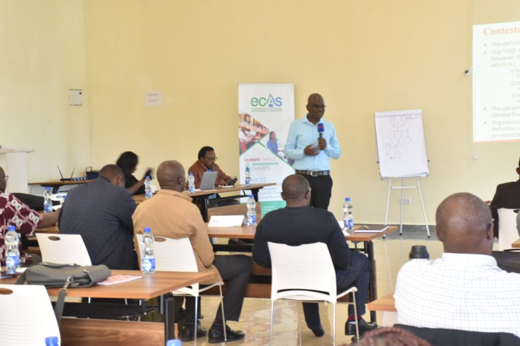
The modules will be taught through PowerPoint presentations, and lectures and will include a case study/field visit, breakout sessions, case studies and other interactive discussion components.
The course will also include a few guest speakers, both in person and via Zoom and other online learning platforms for overseas speakers. This provides useful real-world insights alongside the more theoretical aspects of the course.
The conference faculty shall consist of experienced decision makers, as well as practitioners and representatives from established educational and research institutions active around climate change, engineering and international development. Throughout the course, theoretical presentation of concepts will be moderated and more group discussions and plenary engagements will be optimized. PowerPoint presentations will be made by facilitators and resource persons, to highlight key concepts before embarking on group work.
GENERAL NOTES
- Training manuals and additional reference materials are provided to the participants.
- Upon successful completion of this course, participants will be issued with a certificate.
- We can also do this as a tailor-made course to meet organization-wide needs. Contact us to find out more: info@ecasiafrica.org.
- Payment should be sent to our bank account before the start of training and proof of payment sent to: info@ecasiafrica.org.
ABOUT ECAS INSTITUTE
The ECAS Institute designs and delivers independent and targeted training, research, and consulting services. Our work focusses on climate change and resilience building, carbon markets, renewable energy, nature-based solution, biodiversity conservation, agriculture and food systems, We are located in Nairobi Kenya and work across the African region. We have implemented training and research assignments in Kenya, Tanzania, Uganda, South Sudan, Somalia, Malawi, Rwanda, Congo, and South Africa. Globally, we have supported our partners from the UK, Denmark, Italy, Sweden, Germany, and USA.

